Showing posts with label Los Angeles. Show all posts

Sunday, January 14, 2024

Carrizo Plain National Monument: Road Trips from Los Angeles

Photo of Carrizo Plain National Monument, San Luis Obispo, CA by Armando Ortiz

Carrizo Plain National Monument: Road Trips from Los Angeles

By Armando Ortiz

Decision and intro do the trip:

I had had Carrizo Plain National Monument on my to do bucket list for a while. The number one reason to visit this place was to visit painted rock, which is an outcropping of rock with pictographs on the side walls of the inner sanctum. It is believed that different groups of Californian tribes came to this site and painted images inside the inner rock walls - Chumash, Salinan and Yokut. The ancient pre-Columbian pictographs on the inner rock walls make this location a sacred place. Wildflowers decorating the mountains, hills and floor of this place is also what brings many visitors every year. Being that it was spring and this year’s winter rains started early and ended late meant that there would be opportunities to see an abundance of wildflowers. Aside from that there are many opportunities to explore the surrounding canyons and ridges that ring around the plain. 

Photo of Carrizo Plain National Monument, San Luis Obispo, CA by Armando Ortiz


Background of Carrizo Plain and area:

Carrizo Plain was historically an area that Native American tribes visited. It is believed that the Chumash people would visit this area. Salinan and Yokut people also frequented the area. There isn’t much known about what they did there, but mortar sites and pictographs have been found. Painted Rock is the main place where remnants of a continuous human presence has been found. However, the flowers that bloom in the plain might contain some evidence. In spring many different types of flowers bloom, some being wild onions and tubers that could have been harvested. 

In addition, some of the plants that sprout might have medicinal properties. After Americans arrived the lands in the Carrizo plain were used for ranching and raising livestock, all of which are now just remnants of a not so distant past. As you drive through you see unkempt buildings that seem to be frozen in a time when industrial agriculture was being introduced into the region. Dried out wooden posts once jammed into the earth seem to hang on wires more than create a barrier to intruders. Now people mostly spend an afternoon visiting the sites that open up to vistas.

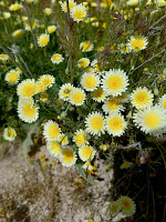
Photo of Carrizo Plain National Monument, San Luis Obispo, CA by Armando OrtizYet, despite the changing demographics of the surrounding areas, the wildflower blooms, and wildlife have persisted. The dry lake bed comes alive after a season of heavy rains. Some of the flowers that cover this area are different types of clover, lupines, gilia, linanthus, ephedra, buckwheat, fiddleneck, thistle, lasthenia, popcorn flowers, desert dandelion, spineflower, and many more. Depending on what route you take, evidence of the different enduring geographical features can be appreciated on the way there. The north and south entrances connect you to winding ridge roads. The eastward road winds out of the mountains and onto the easterly slopes that slowly and gradually take you down to Interstate 5.


Route taken and what we saw:

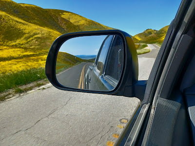
            Carrizo Plain is about 130 miles away from Los Angeles. We took the route that starts off Interstate 5 around the Fort Tejon area which takes you to Mt. Pinos. You exit Frazier Park and head west. At first the way is straight with a steady climb that goes into a barren valley where people probably grow hay. Along the way you drive through a town called Pine Mountain Club, which seems like a mix between a resort and private cabins community. This road winds its ways through the mountains and areas that have signs informing everyone that you are passing through private land. There are various off roading opportunities along this highway and camp sites if that is what you are looking for. The road changes several times, but as long as your destination is Carrizo Plain you’ll be able to navigate your way there without a problem. 

Driving there the chaparral landscape and open valleys become lush pine forests and transition into more barren ridges that open up to views of the San Joaquin Valley. We drove through this area in the Spring and at times the sides of the mountains were covered with different layers of colors, which at times it felt like we were looking at giant slices of cake that had tangy orange icing, and mellow purple ume layers. Driving through this section felt like driving on a plateau and yet the road winds like a moving snake. Roads like these are perfect for those that have sporty cars and like taking weekend drives in the mountains.

Photo of Carrizo Plain National Monument, San Luis Obispo, CA by Armando Ortiz


Carrizo plain and activities:

There are two main reasons for visiting this unique geographic/geologic site. The wildflowers that bloom during spring, and sites of Native American life. Another reason for visiting is to do some off-road driving along the dirt roads that go up ridges and take you to sites that sedans and low clearance vehicles aren’t able to go to. 

Our visit was during Spring Break, and the place was busy with nature lovers, flower enthusiasts, mountain bikers, hikers, and people that simply want to go see once carpets of pastel colors covering vast stretches of land. In specific areas, where the blooms were lush and vibrant, cars would park on the side of the road. You’d see people balancing a camera on a tripod to get the perfect close up picture of a delicate blazingstar or gilia. Many visitors wore shades and wide brimmed hats because the elevation makes the sunshine strong. All of us seemed to enjoy the brilliance of the yellows and delicate whites that seemed to be tiny sun bursts.

I was able to see painted rock from a distance, but would have liked access to the site. It’s a dream of mine to one day go there and see the site for myself and wander inside letting my mind wonder what took place there. To many tribes this was their frontier. It was a place of encounter, but also a place where you could reflect on the finiteness of life and the enduring might of nature. Yet, in those instances of thought you might glimpse the images etched by people hundreds if not thousands of years ago. Further east is the San Joaquin Valley and the Sierra Mountains. From that side of the ranges, stones for making tools were traded, and brought to these places, and used to make arrows and spears. One could only imagine what else could have taken place here.

We drove into one of the unknown roads and headed towards SUVs that could be seen at a distance. The truck was set to four-low and drove it up to a steady speed. It felt magical. The gravel being pulverized by the all terrain tires, and the cloud of dust it made was at times amusing. Wildflowers were on all sides, and at one point I could see a small valley that was covered in varying shades of purple and dark blues, and different hues of yellow and orange. I stopped the truck on one of the roadside stops to take photos. There were moments of silence where all you could hear was the sounds of music emanating from the truck. At other times you could hear the light chirps of the birds that crossed our sights which only made the drive ever more pleasant. 

Photo of Carrizo Plain National Monument, San Luis Obispo, CA by Armando Ortiz


Ending and review:

The drive to Carrizo Plain National Monument varies from whichever side you decide to enter from. The drive will have varied terrain and will showcase a wild landscape that at one point was tamed with the arrival of Europeans. The views of this not so distant past are found across the land which now contains only barbed wire and farm houses that seem on the verge of collapsing. On the other hand an industrial landscape where pumps suck the hidden black gold that is found within the deep layers of rock. On top of all that the plain itself is a wonder of the life that it has sustained, and becomes vibrant every spring. Viewing wild flowers is one good reason to take the drive here, and another is to enjoy a drive through Frazier Park and its different winding roads that quickly make you feel like you are driving on top of the world. You will definitely see a couple of sports cars zoom bye if you take this route. Exploring California is always an adventure.

Photo of Carrizo Plain National Monument, San Luis Obispo, CA by Armando Ortiz


Wednesday, January 3, 2024

Northern Sky: Free-Verse

Racetrack Playa, Death Valley, CA photo by Armando Ortiz

Northern Sky: Free-Verse

By Armando Ortiz


I was conceived in the heart of a growing city

where youth overflowed and were pushed north,


I was born under the northern sky

towards the west where Aries floats near Perseus.


I gave my first cry to the angels of that place,

while they were busy chasing stars.


I was followed by its galactic embrace,

inside planes and mountain trails.


It’s been a silent shelter,

a deep blue safety blanket. 


It’s protected my journeys,

together we traced the contours of China.


It’s kept me warm under the splendor of night 

and bathed me with the cover of midday light.


Its midwest sun passed me by

as I raced towards the western mesas.


In the endless hours through unknown places,

the suspended constellations were my anchor.


Even as I sailed deeper into the ocean of life’s experiences,

the daily burst of stars became the coast of my youth.


Where the waves of time crash with the moment,

and the sound of the turning universe births each second.


Wherever I was, there it was

a different hue of blue but always true.

Mongolian countryside, photo by Armando Ortiz


Friday, December 29, 2023

City River: Free-Verse

City River: Free-Verse

By Armando Ortiz


All the rain of a wet season,

wouldn’t clean this river.


The egret stands atop a grocery cart,

like a homicide detective wondering,

when the streets will be cleared of its filth.


A billion summer tsunamis,

could not purify the water.


The egret contemplates its murky reflection,

like a mysterious figure wearing a peacoat,

the school of fish looks suspect from the outside.


Melting snow from the  Tujunga mountains,

is unable to change the course of the city.


The egret lazily raises a foot,

rusty flakes falling into the current,

it watches a rainbow of plastics float bye.


A never ending mega drought,

wouldn't stop this arroyo from resurrecting.


The egret slowly dips its claws in the stream,

ancient dancer lifting its gray hakana,

despite all the distraction the cycle persists.


Rush hour traffic and midnight flows,

can’t silence the trickling sounds of water.


The egret reenacts its movements,

shoots its beak through the waters edge,

a small frog is trapped as the sky darkens.


Suburban medication  and the urban chaos,

couldn’t stop the river reaching its destination.


The egret glides through the crying willows,

rises up the stream that’s eternally etched,

follows the contours that lead to the ocean of time.


Wednesday, December 13, 2023

Summer's Arrival: Free-Verse

Jacarandas in bloom, photo by Armando Ortiz

Summer’s Arrival

By Armando Ortiz


Jacarandas dry up 

as they fell and landed 

on the sidewalk, 

a purple carpet 

welcomes our walk.


Jasmine fragrances blend 

with the warming days, 

tiny white flowers burst

Summer's sudden arrival.


Traffic lights turn red,

a humming is stalled,

destinations unknown

in cars people forever roam.


Sparrows perch on branches,

feeding crying chicks.

Hummingbirds hovering besides

crimson nectar feeders.


Sycamore trees lush and green,

swaying with the wind,

cars resume their drive,

artificial breeze picks up. 


Offshore currents

blending with westerly flows,

longer warm days mix with

the humdrum of summer’s arrival.

Tuesday, October 17, 2023

The Golden Hour of LA: Free-verse

Photo by Armando Ortiz, Golden Hour

The Golden Hour of LA

By Armando Ortiz

The glow of the sun still bursting through the incoming night

lights still reflected on the side of the northwest facing glass,

contrasting an orange glow to the dark silhouette.

The city lighting on, adding a delicate air of earthly stars

low beam headlights reflected from the traffic signs.

A flow of geese form an incomplete V crossing the sky

and at a distance the trails are dry and the color of clay.

The chaparral covered hills turning into unknown shadows,

white, purple, and black sage merging with the wind.

The golden hour quickly fades into the evening

peaceful serendipity as the instance lingers in the clouds.


Thursday, June 29, 2023

Kayaking on the Los Angeles River

Kayaking on the Los Angeles River 

By Armando Ortiz

Have you ever floated down the Los Angeles river, catching sight of the traffic on the 110 freeway from within the shadow of a willow tree? Kayaking the Los Angeles River was a unique and memorable experience that exceeded my expectations. A few years back, I had come across an article or news segment on how kayaking was now a possibility on the L.A. River. Kayaking on any body of water was not on my itinerary until recently so I decided to give it a try. With a camping trip to Yellowstone and Grand Teton National Parks on the horizon, I wanted to gain some practice and training in kayaking so that could be a possible option on the lakes over there. That’s when I discovered the LA River Kayak Safari, which offered local kayaking tours, classes and activities on the river. Last year’s unprecedented rain falls really made me decide to follow through and sign up for one of their excursions.


The LA river, which originates from the northwestern edge of the Angeles National Forest, the Simi Hills and Santa Susana mountain. There are other areas that would drain into the Los Angeles River. According to the owner of the company, Mt Washington and the surrounding hills also contributed as a water source to the river. The areas along the river were peppered by Tongva villages, Native American tribes, by the time the Spanish missionaries began exploring the areas. The river was a  vital water source for the Tongva, providing food like fish and nuts from trees, shelter from from young willow trees and tule whose branches and reeds made up the frames of their dwellings, and resources for tools, like grinding stones, and the raw materials necessary for basket making were found along the river. Exploring the river allowed me to appreciate the historical and cultural significance of this natural waterway. It also combined what I’ve learned in books and articles with a hands-on activity that puts me in an outdoor setting.

Our kayaking adventure began at Oso Park, where we met our guides and completed the necessary paperwork. We then chose bikes to ride to the staging area, which was located about two to three miles north along the river. This unique mode of transportation added an extra element of anticipation to the experience. It was also my first time riding along the Los Angeles river and the weather was perfect. At the staging area we were given a brief lecture on the Los Angeles river, and ancient villages that once existed in the area, as well as information on the local frog population that continues to endure, and when the river began to be contained within concrete walls and channels. Afterwards, we were given paddles and instructed on how to handle the paddles, basic movements to turn left and right, and ways to turn once in the water, after which we strapped on life vests and were ready for the adventure.

Once on the river, I was immediately captivated by the serene beauty of the surrounding. Native plants create a green cover, along with oaks and willow trees giving an occasional respite from the sun. The LA River is home to a variety of birds, which include white egrets and blue herons which stand elegantly and more like kabuki dancers along the water. A black necked stilt greeted me along the way as their sounds broke the solitary silence that was experienced at times. The occasional sight of fish jumping out of the water added to the sense of nature’s enduring presence. Being my first time kayaking, I focused on trying to paddle correctly and to be in sync with the pace of the group, but also took moments to appreciate the wildlife and scenery around me. Ducks, geese, other waterfowl added to the vibrant life of the river’s ecosystem making any signs of city life a distant backdrop.

In conclusion, kayaking the Los Angeles River was an excursion that provided both a recreational activity and a deeper connection to nature. It offered a glimpse into the historical and cultural significance of the river, as well as a chance to appreciate the diverse birdlife that is hardly ever noticed, and natural beauty it harbors. The LA River Kayak Safari provided excellent instruction and guidance through the trip, making it accessible even for a newbie like myself. Along the way, I received tips on maintaining balance in fast currents and was reminded of the proper way to hold the paddle. As I paddled along the river, there was a profound sense of peace and tranquility, moving with the flow and discovering my rhythm. The gentle sway of the willow trees, and the graceful presence of egrets and herons all contributed to a feeling of harmony and deep satisfaction. Kayaking the LA River was more than an adventure and a safari; it was an opportunity to disconnect from the bustling city life and immerse myself in the natural wonder that our city has to offer. I highly recommend this experience to anyone looking to explore a unique aspect of Los Angeles and immerse themselves in an outdoor adventure and make a connection to our natural environment.


Monday, June 26, 2023

Hiking Mount San Jacinto via Deer Springs Trail

Photo by Armando Ortiz

 Hiking Mount San Jacinto via Deer Springs Trail

by Armando Ortiz

I started the hike at 5am, right as the sunlight began cresting over the horizon, and returned to my car by 6pm. This was my first hike up to Mount San Jacinto. This was a journey through changing landscapes that opened my eyes to what once was happening in these areas. Slopes of the mountain face underwent a remarkable transformation as I ascended, shifting from a sandy dirt trail surrounded by manzanita and oak trees to rugged gray rock boulders intermingled with pine outcroppings. The shadows of trees, and bushes just as well changed throughout the day and were like on complete sundial. Rock formations and uninhabited clearings indicating past life. The hike to the summit makes the Deer Springs trail unforgettable. Any hike that allows you to see the change in the different ecosystems within a mountain range is always special and memorable to the senses. 

Photo by Armando Ortiz

To reach the top of Mount San Jacinto an early morning start is recommended. If this hike is done in the summertime there will be sufficient time and sun to complete the hike. There will be two places where water can be gathered depending on which route you take once you reach Strawberry Junction. This day I chose to take a left and head north along the trail. The morning breeze was refreshing and the day was clear. These stretches of the trail are wooded and there will be plenty of shade.

Along the way one might see things that otherwise are overlooked at times. Fallen tree trunks at times looked like crow wings that decorate the ground as signs of past fires that had burned through the area. As one continues climbing you see granite outcroppings, some looking like Olmec figures covered in shrouds while other rocks are huge boulders that have been weathered for millenia. 

Although the hike was difficult, the desire to reach the top became more and more intense as the landscape changed. Although difficult the trail gives a sense of serenity as you discover different fauna and hear the wind blow through the branches of pines and chaparral. There is enough variance in this changing environment that the eye stays stimulated. Before reaching the summit I refilled all my water bottles at Deer Springs, which seems to have water flowing year around and a few feet away the PCT connects with the trail.

Photo by Armando Ortiz

As I began my descent the trail revealed some things along the way that allowed me to make connections to what I had seen on the way up earlier in the day. I took a loop on the hike up, and descended on the east facing side of the summit along Peak Trail. This side of the mountain is more exposed to the elements, hiking down the trail is easy, and lined by bushes. Palm Springs can be seen at a distance if you stop and look east. I reached a section that was marshy and had plants that seemed to spiral up tall with a vibrant green. Water seeped out of the mountain on this section of the trail. White granite rubble piled up along a slope seem like caves where natives might have sat and studied the sky. The thick walls and hangs serve as protection from sudden storms of summer heat. 

Photo by Armando Ortiz
As the afternoon sun slowly moves across the horizon the shadows of the boulders seem to turn into prehistoric statues and monuments. These looked like the ruins of Greek temples with its slabs laying flat one on top of the other. Most of the trail was quiet, with occasional hikers and backpackers headed up to the summit. The trees sway and the plants stand tall and vibrant indicating that water is near. I leaned on one of the boulders to keep my balance as I stepped over a root and the warm boulder told me of the warmth that was still ahead on the other face of the mountain.

 As I reached Wellman Divide, the sun’s rays served as a reminder that it's summer, and was suddenly rewarded by fabulous views of Idyllwild’s granite canyons making it the perfect location to take a water break and enjoy views of the town below. At this junction bedrock mortars, like giant buried bowling balls, reveal signs of ancient communities that once existed and made their trek to this place reinforcing a belief that this mountain has always been visited and has been the perfect place to take a rest. Once you begin nearing Strawberry Junction you see broken pine trees damaged and altered by boulders that freed themselves from the upper slopes, held sideways by black oaks that resemble canoes. As you descend you feel the rough edges of the rocks rub against the soles and sides of my boots.

Photo by Armando Ortiz

On the way down there were times where the trail seemed to change directions, and I had to stop and reorient myself. It was as if something were pulling me towards other directions where I could have gotten lost. I began to wonder and ask myself if the mountain was communicating something to me. Of course this is all idle talk. As I was coming down I began to notice what appeared to be directional markings covered in pine needles and dirt that indicated to a direction or a place. These markers were likely man-made, as I later learned that Native American inhabited this place in the past. At some point I wondered if the dead manzanita branches were covering up what lay beyond. Cleared spaces seemed to be evidence of possible seasonal villages or places where people once processed nuts.

I made it back to the car, my mind remained filled with the dazzling sights I had experienced and remarkable connections I had made along the way. Intrigued by what I had seen, I decided to do some research after returning home. I searched for the trail that I had hiked earlier but now seeing it from a slightly different perspective. I discovered that along the trail there are areas that are like patches of meadows where people could have set up communities. It turns out that the surrounding Native American tribe, the Cahuilla people, had a connection to the mountain and seasonally migrated to these areas. There is even a boulder, about a mile away from the trailhead, that has pictographs that women would visit and write on the walls of this boulder as a coming of age ritual. The boulder that looked like a giant bowling ball most likely was a site for processing acorns and other nuts. 

The top of the mountain was crowded with all kinds of people feeling accomplished, and as I write this down I wonder if the ancient had the same feelings once they reached  the summit and gazed down at the lands and places that they called home. People from all directions, Idyllwild and Palm Springs reaching the top and taking pictures, me included. Different tribes at the top of this mountain exchange greetings and rest on the rocks. Truly this is a mother mountain that has had a significance for people all over the area for a millenia and continues to be silent.

Photo by Armando Ortiz


Thursday, December 8, 2022

Moon Over the High Desert: Road Trips from Los Angeles

Photo by Armando Ortiz

Moon Over the High Desert

By Armando Ortiz

Driving on the Pearblossom Highway, anytime of the year, can be a magical experience, especially during a full moon. It offers a serene and reflective journey with breathtaking views of the Angeles, the San Bernardino and distant Mojave Mountains. Allow me to briefly explain why driving along this road is a worthwhile endeavor, especially during a full moon while heading east.


To begin your journey, you drive up the I-5 from LA and take the 14 north. Once on the 14, you continue until you hit Pearblossom Highway, where you exist and continue driving on for a while. Along this route, you pass by Palmdale, Little Rock and the town of Pearblossom. As you maintain a steady speed of 60 mph, the engine purrs like a cat, and a sense of surrealism washes over you. Thoughts of Victorville and visiting relatives become distant memories. Personally, I often take this road when I visit my relatives or when  there’s a major accident on the I-15 north, necessitating a detour in that direction.


While driving this section, especially in the late afternoon, I recommend playing your favorite tunes and savoring the moment. As the moon begins to rise over the Mojave Mountains, it casts a radiant glow akin to a giant spaceship emerging from the earth, evoking a sense of awe in the surrounding Joshua trees. The moon’s luminous light gradually spreads west, illuminating desert mountains. Its glow paints shadows of Creosote bushes and sagebrush on the ground. The spectacle begins to take place late in the afternoon, just before the sun sinks below the horizon, when the sky transforms into a deep orange hue that rapidly fades westward.


Taking a drive through this frontier, one of the few remaining desert backcountry environments in Los Angeles County, is an experience worth having throughout the year. Residents of LA should make it a point to drive along this highway at least once. Here, you can witness the desert fauna rarely seen in the city. The branches of the high desert trees resemble human arms stretching towards the heavens, frozen in time like statues holding the sky, waiting for the moon’s gentle touch. These trees seem to celebrate and honor the moon’s ascent from the depths of the distant mountain ranges. This yucca plant found here is aptly named, symbolizing the time Joshua kept the moon in place while raising his arms towards the sky in prayer.


Heading east on Highway 18, you’ll notice the dark silhouettes of giant yucca trees seemingly guiding the moon across the sky, moving it branch by branch, like miniature arms moving a white sphere. It’s as if they were directing it towards the Angeles Forest, where it descends below a sea of blinking lights that adorn the western slopes and coastline. The diverse desert bushes appear to dance in celebration to a rhythm known only to the wind and moon.


Frequent drives along this desert highway reveal subtle changes in the landscape. Life is a constant process of change and transformation, and the high desert exemplifies this truth. These changes become especially apparent during daylight hours. You might happen to see CalTrans widening a section of the highway or a house suddenly appearing where yucca trees once stood. A dirt road may now cut through the dry wash that flows during Spring. Construction crews seem to emerge out of thin air to complete the construction of a stoplight. Occasionally, you may spot crows soaring above, chasing after discarded hamburger wrappers. 


This land, once being mostly sagebrush, chaparral and desert plants just a few decades, years, or months ago, now appears devoid of life. Vast acreage is cleared as if a giant wooden block had been placed and later removed, leaving behind perfectly squared corners and open spaces. Sometimes, you come across makeshift communities of city squatters who have been pushed to the fringes of the city and into the high desert, their motorhome enclaves resembling wagon forts from a  bygone era.


As you continue your drive, the majestic Angeles Forest mountains, a constant backdrop to the city of Los Angeles, continue to fill their role. Here, the landscape takes on a juxtaposed nature. In the city, these mountains face south, but on this captivating drive, they face north. Aside from Palmdale, Little Rock or Pearblossom, there are no prominent cities or urban areas as you drive south. The homes that dot the mountainside seem to disappear into the chaparral during the middle of the day, blending seamlessly with the natural surroundings. At night, scattered yellow lights give the impression of Christmas decorations scattered across the land, occasionally accompanied by long robotic arms glowing- usually gravel companies working on their pits. Further along your drive, these lights indicate the presence of Valyermo and Phelan, towns nestled closer to the mountain range.  


Driving through this highway is a year around adventure, with each season offering its own unique character and feel. Winter unveils mesmerizing lights adorning the local ski resorts, flickering through the night as they create artificial snow. During the day, after a major storm, the mountains don a thick blanket of snow which can be seen for miles. The northern face, receiving the least amount of sunlight, combined with the absence of air pollution, presents truly spectacular mountain views. Spring, too, can be quite special too, with gentle brush strokes orange, purple, lavender, yellow, and white sweeping across the high desert landscape. As you roll down your window, the air feels cool and clean. In a good rainy season, millions of vibrant orange poppies dance with the wind as you traverse the 14 north. Later in the season, stoic Joshua trees, along with other yucca plants, proudly display their white stems holding delicate white pods containing seeds, while bushes bloom in shades of yellow and white. In the distance, the Angeles mountains still boast their snowy crowns.


Summer and Autumn transform the drive along this highway into a dreamlike experience. Despite the hot and dry weather, there is much to relish. If you drive in the opposite direction, you’ll get treated to dramatic sunsets behind the Tehachapi Mountains. Sunrises are equally captivating, with hues of yellow, orange, purple and blue blending seamlessly across the sky. The wind during this time serves as a reminder of why the resilient desert fauna that has withstood the test of time. It’s also the perfect opportunity to pull over and admire the stars on a clear night or to quench your thirst with a refreshing blueberry smoothie from Charlie Brown Farms in Little Rock. During this period, the yucca plants release their seeds to the ground, and other desert plants fill the desert air with a fragrant aroma. This desert environment also experiences  its fair share of monsoon weather, and late summer flash floods serve as a reminder of nature's unpredictable power.


For an exploratory detour, you can take the 138 and connect to highway 2 on the San Bernardino side. By making a right turn on Sheep Creek Rd, you’ll have the opportunity to traverse the mountain crest, winding through the backbone of the range and reenter Los Angeles through La Canada. Alternatively, you can continue on Highway 18, passing Adelanto and venturing into Victorville. Here, you can find a place to have lunch or continue on your road adventure by joining Interstate 15 and heading south towards Hesperia. As you descend along the highway, winding your way down El Cajon Pass, glimpses of urban life gradually emerge through the city lights of San Bernardino and Riverside county, along the connecting nodes of the I-215, I-10, and Highway 60.

In Southern California, where car ownership is prevalent, day trips are a common pastime. Traveling north past the mountains can create special memories, and provide a relaxing and reflective experience. The drive also allows you to appreciate the remaining wilderness that exists just an hour away from where we live. It serves as a reminder that this ecological region is a desert environment, and the unique flora and fauna should be appreciated and respected. Even after a summer rain, you can catch the lingering scent of sagebrush and native plants in the humid air. A journey along this highway becomes a rediscovery and a discovery of something special, connecting us with nature and ourselves.


Photo by Armando Ortiz