Showing posts with label eastern sierras. Show all posts

Wednesday, August 7, 2024

A Quiet Retreat: Free-verse Reflections


Gilbert Lake, Kearsarge Pass Trail

A Quiet Retreat: Free-Verse Reflections

By Armando Ortiz


I sit here along the coast after a thirty minute drive on Pacific Coast Highway, lying on the sand, watching the waves roll in, each one bringing solace.


The crashing waves blend with memories of hiking the Sierras, where a cool breeze touched my skin as I prepared myself to enter the alpine lake. In the deepest silence, as the waters pulled back, a tiny mosquito pierced my skin with its sharp bite. 


Lost in thought, the crashing waves transform into a gentle rustle of aspen, pulling me back in time. The memory intersects with the present, where the sounds of water and breeze become a delight. 


No need for kegger parties or psychedelic nights; just nature’s embrace heightens the senses, offering deep insights. This mid-July heat wave intertwines with every other summer breeze and every tiny insect that takes flight. 


A single mosquito stands as a buzzing reminder, its bite added to my life's itchy welts. Palm trees and cottonwoods wave gently at the endless stream of people, serene spectators to the flow of life.


If only my tent could transform into a permanent retreat, a place to watch sea lions surfing the dawn’s first light. Or a home nestled among oaks and pines, their gentle shade shielding me from the afternoon’s oppressive heat.


High on a hill, where no buzzing mosquito will dare to exist, a refuge of tranquility. Back at the coast, the sand scorches beneath my feet, but the ocean’s blue embrace offers a cooling reprieve. 


Who needs a retreat when nature’s wonder is just a few minutes away?


Thursday, May 30, 2024

Ascending Mount Langley: Reflections from the High Sierra - Part Seven


Mount Langley, Cottonwood Lakes, Horseshoe Meadows, CA photo by Armando Ortiz

Ascending Mount Langley: Reflections from the High Sierra - Part Seven

By Armando Ortiz


Final Reflections:

Did you ever cram for a test the night before? Long hikes and backpacking are quite the opposite. They require time, effort and thorough preparation. After my backpacking trip, I realized how crucial preparation is for long treks. This involves consistent practice and training. You must work out regularly. You can’t decide that you will hike Mt. Langley the day before- it can be dangerous.

 Before this trip I’d been hiking 4 to 6 miles on the weekends, regularly increasing the distance and elevation as summer approached. Each hike included carrying a 15 to 17 pound pack, building my resistance and endurance. During the weekdays, I took daily walks and lifted light weights twice a week. The week before trekking up to Mt. Langley, I completed a 15-mile hike up White Mountain Peak with a 3,400 feet elevation gain, which indicated I was ready for Mt. Langley- a two-day trip with an additional 5-6 miles and double the pack weight.

Looking back, my clothing was sufficient, but I’d make some minor changes. A long sleeve shirt, and windbreaker provided good sun protection, but a long sleeve hoodie, a good cap, and a rain jacket would be perfect for high elevations. This setup gives me cover from the sun, wind resistance, and insulation. While my sun hat worked well, using the hoodie in windy conditions covered my ears, affecting my peripheral vision and muffling sounds.

The water filter worked fine, and knowing that there was a source near the camp to fill two liters of water was convenient. Using a light dayback for the summit gave me more freedom of movement and allowed me to just carry the bare essentials, making the climb faster. However, my main pack, over 20 years old, couldn’t distribute the weight evenly. The straps loosen up, and the shoulder straps dug into my shoulders. A new pack is needed for better performance.

I brought more food than necessary, adding weight to the pack. The extra food provided an option to stay another night and rest after the summit, though I didn’t take advantage of that opportunity. I carried energy bars- blueberry and lemon. Interestingly, my taste changed slightly at higher elevations. The spiciness and saltiness of peanuts were nourishing, but the lemon snacks were tastier, with their chewy tartness providing an extra kick of satisfaction.

Monitoring my hiking app for trail updates and tracking the weather conditions online helped me to choose the best route. Before the trip, I read that New Army Pass, though longer, was safer. Knowing as much as possible about the trail conditions is always helpful. Dedicating time to study the topography of the wilderness area helped me anticipate sections along the trail. I knew that reaching High Lake would be moderately easy, with 400 feet elevation gain. By studying the map I was able to identify water sources, with High Lake being the last one before going up Mt. Langley. The toughest section of the trail was near the summit, with eroded terrain, but the cairns facilitated navigation.

Choosing a better location to camp that was less strenuous to the body could have spared unnecessary energy expenditure. Staying one or two miles further down the trail would have reduced the burden of carrying a heavy pack. The one lesson learned was to take down camp and leave everything packed for the return if not planning to stay the night.

Rushing and trying to race the sun gets you in trouble. My arrival was delayed due to the drive, and I started later than expected. Lunch was rushed because I wanted to reach High Lake before sundown. The next day, after a full day of hiking, I quickly packed up to beat the sun. Pushing my body to its limits was risky. My knee, already bothering me before the trip, worsened due to the rush. Being well rested is essential for a successful trek, especially before covering many miles in a day, but also pacing yourself and being aware of time.

Finally, car maintenance is crucial for any long trip. Although I checked the oil before leaving, inspecting other parts like air filters, tire pressure, and the radiator cap could have prevented potential issues. Ensuring your vehicle is in good condition contributes to a successful trip.

Preparation gives you mental space and physical endurance to make informed choices. During a trek, if you feel like you’re disoriented physically or mentally, you can take a moment to pause, breathe, and reflect before making the next decision. At the summit, I wondered how Covid-19 might have affected our physical endurance. Yet, I successfully submitted Mt. Langley. Fortunately, my body persevered, and I made it back to my car. This experience reinforced the importance of preparation and planning for any endeavor, ensuring a successful summit, hike, backpacking expedition or trip into the wilderness.

Mount Langley, Cottonwood Lakes, Horseshoe Meadows, CA photo by Armando Ortiz


Monday, April 22, 2024

Ascending Mount Langley: Reflections from the High Sierra - Part Six

Mount Langley, Cottonwood Lakes, Horseshoe Meadows, CA photo by Armando Ortiz


Ascending Mount Langley: Reflections from the High Sierra - Part Six

By Armando Ortiz

Almost there:

The last two miles were slow going and the rolling mounds were more like long slow steady climbs. Although the trail was well defined the ground was annoyingly unstable. It wasn’t sand what I was walking on but tiny bits of granite which were both airy and not compacted. My breathing and keeping an internal rhythm were the only things on my mind. The weather was much warmer than it had been at the top with my skin feeling sticky. 

I found myself taking breaks every ten minutes. Finding a rock the height of my waist made a perfect seat to take a few moments of rest. There was a sense of relief that the air I was breathing was warm and earthy. Some areas in this section had open spaces that looked like they might have been seasonal villages for the Shoshone. From this section to the lakes it is less than 4 miles away, which could have provided fish and game for people. Along the edge of the lakes I couldn’t help but wonder if some of the flat and slick boulders were used to process meat and seats.

It looked like a perfect meeting point where people for thousands of years gathered in the summer and trekked into the mountains to hunt and collect food. Many of the lodgepole pines on this last stretch were far enough apart that numerous temporary shelters could have been built. The area provides enough shade from the sun which would make it ideal for a summer’s stay. The weather is slightly cooler to the hot Owens Valley. Then again their meadows could have easily been created recently. The lakes could have been an excellent source of water to the first peoples that called these mountains home. Although I was moving like a tortoise and found myself pondering how the first peoples lived in these areas, I knew that I was nearing the end of my trek.

Mount Langley, Cottonwood Lakes, Horseshoe Meadows, CA photo by Armando Ortiz

I could sense that I was nearing my last few meters. On the last turn of the trail I finally descended towards the left and could see a sign. I had made it back, relief and accomplishment filled me. My car was close. As soon as I reached my car I took a long gulp of water, and attempted to send a text. There was still some light, though the sun was quickly beginning to set. I quickly changed clothes while I boiled some water on a portable stove.

Dinner- shrimp ramen with chili and a packet of jalapeno tuna fish. The meal was comforting, the broth savory, and salty liquids would replenish me of the fluids I’d lost throughout the day. The vapor touched my face and the condensation mixed with my skin.

 After the quick meal I opened the hood. All the coolant in the reservoir had either evaporated or leaked. I turned the radiator cap, it was broken, but there was liquid in there. I searched for residue of coolant salts along the engine hoses and below the car and didn’t see any. There was some residue under the reservoir which made me conclude that coolant had escaped from there. I did not have to put water in the reservoir. The broken radiator cap could have been the source of the car losing the coolant. I returned to the drivers side and hoped I was right with my final inspection, the car could at least get me to Lone Pine.

The engine quickly turned on and began to hum as if nothing had happened. Good old reliable Toyotas. I returned to check the engine, and all was clear. I decided to drive down towards Lone Pine and from there I’d see how the car was doing. It would not be as taxing on the engine as it had been coming up and the weather would be slightly cooler. As I left the campground the forest seemed to merge with the darkness. I drove slowly down the winding road.

Arriving at the Lone Pine intersection the car seemed to be humming along without a problem. I pulled to the side and sent a few quick texts, made a right and merged with the 395 South bound. Family was glad to receive my messages and I was glad to have made it down to the valley. Everything was surprisingly fine. The drive home was smooth, with a stop at the town of Mojave where I filled up on gas and bought some snacks. 


Wednesday, April 10, 2024

Ascending Mount Langley: Reflections from the High Sierra - Part Five

Foxtail Pine, Mount Langley, Cottonwood Lakes, Horseshoe Meadows, CA photo by Armando Ortiz

Ascending Mount Langley: Reflections from the High Sierra - Part Five

By Armando Ortiz

Approaching the Final Stretch - Initial Reflections:

The trail changed as I descended. Rockslides had been cleared, and people had taken shortcuts. The way along the canyon face didn’t seem as stable as it had earlier in the morning when I climbed up. Now High and Long Lake looked like big rain puddles in the sunlight. Though it was a bit past three in the afternoon, it felt directly overhead, casting minimal shadows. I kept looking towards the boulder where my tent was, wondering if marmots had entered or nibbled a hole into the backpack.

Around that time a group of three or four were ascending the pass. We greeted each other and continued on our way. After about an hour the trail began to even out slightly. New Army Pass now seemed like a canyon of hightowers. More and more patches of green mossy grass came into view the lower the elevation it got. My steps going down were slow, but my body felt light. I scanned the trail below when suddenly my eyes saw wildflowers moving with delicate excitement as the breeze blew. Things were looking good. After reaching the foothill, I searched for my tent.

The tent was missing. As I approached the granite boulder, my green backpack came into view. Vexed, I stopped and looked around. It was packed, and under it was the tent. My eyes scanned the scene in confusion. Under the bag was a note that read, 

“Hello, From the top of Army Pass, we saw your tent getting blown away down the mountain. We retrieved it 9000 years from your site and also found your sleeping bag a distance from your tent. We collapsed our tent and secured all your stuff (that we could find) with rocks. Your tent is damaged (torn a bit) I hope you didn't lose anything. Take care” - Jim

A sinking feeling inside hit like a flash as I simultaneously wondered, “why didn’t I pack my tent?” It could have taken 5-10 minutes at most getting everything packed. In the rush to summit the peak as early as possible, the tent not being as secure and anchored as it was supposed to be didn’t cross my mind. 

This was a valuable learning experience. If I’d been on a multi day trip and had decided to summit a peak I’d be in trouble. Discovering that the tent was in tatters, the sleeping bag torn, and being 20-25 miles away from the car would have been trouble. My bear canister was where I’d left it, so I pulled it out and used it as a seat. 

I reflected a bit on what had happened. As late afternoon approached, I scanned the area to ensure that nothing was missed by those that recovered my tent. Two aluminum stakes were still on the ground where I’d jammed them into the earth the night before. After making sure I’d scanned my area carefully, I paid attention to quickly inspecting the damage.

As I held the rainfly in my hands it looked like it had been attacked by an angry feral cat. The bottom of the tent was torn and scratched a bit, while the mesh area had one or two holes- it was no longer usable. The footprint was pretty much done. It was made of some type of flimsy plastic. The sleeping bag was ok, no visible sign of damage, maybe superficial scratches, but none that had gone through. 

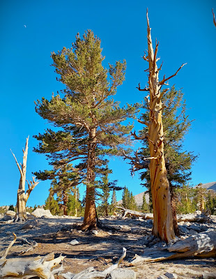
Pinus balfouriana, Foxtail Pine, Mount Langley, Cottonwood Lakes, Horseshoe Meadows, CA photo by Armando Ortiz

This set back definitely had me thinking for a bit, but my attention immediately went to reaching my car. I took a short break and gathered my thoughts. Everything seemed calm and quiet. I sat there, eating a granola bar and glanced at my watch. I could still get to my car with the afternoon light that remained. At a distance a marmot stood up to inspect the views. The lake was like a mirror and I was an audience to the sky. Looking around I realized I had set up camp in a place with lots of marmot activity. There were burrows and feces all around the boulder. 

Reflecting on the situation, I realized that packing up the tent before leaving could have prevented damage and loss of stakes, ultimately avoiding a failed attempt to repair the damages. With these thoughts lingering, I ensured the area was clean before resuming my descent. 

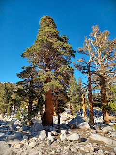
The pack felt heavy, and uncomfortable. I wanted to make it back to my car. Afternoon light was slowly turning into late afternoon shadows. The walk was steady, but I kept leaning slightly trying to give myself an impulse forward. I zigzagged my way through a foxtail pine grove with knotty branches. The gnarled trunks made them look really ancient. Red bark of these pines was contrasted by the evergreen bristles they held. I reached the Cottonwood Lakes around half past five in the afternoon.

 Passing by the lakes different campsites were spotted. I thought of the two miles I could have saved in carrying the weight. My backpack kept loosening up. I stopped several times to adjust the straps. At times I’d wiggle my thumbs in between my front shoulders and the straps to relieve some of the pressure. 

As the descent grew increasingly uncomfortable, I failed to realize that I had already hiked seventeen miles. The next five miles were slow, grinding and potentially dangerous. As I got closer to my destination it felt like I was carrying more than what I had started this adventure with. My pace was much slower, but the trekking poles kept their constant ticking sound.

Reaching the last five miles was a bit of relief, but at the same time began to feel greater discomfort. Here the air had seemed heavier and earthy. You could almost breathe in the greenery. Around six in the afternoon, a bit past mile twenty, and a few meters past the John Muir trail I ran into two backpackers that were beginning their week-long trek through the mountains. “Do the lakes have water?,” one of them asked. “Yes, but they were half full.” We all continued on our way. A tiny bit of jealousy did creep up while talking to them, hearing that they’d be up here much longer than I had. Their carrying load was definitely much more than mine. These encounters reminded me of the journey’s camaraderie, but also of the remaining distance ahead. 

Cottonwood Lakes Trail, Mount Langley, Cottonwood Lakes, Horseshoe Meadows, CA photo by Armando Ortiz

Despite nearing my car, the remaining three miles still seemed daunting. The trail was gradually flattening, but the ground was now soft, bordering on squishy. Every step I took seemed to make my feet sink into the fine gravel. I was tired. I’d stop, lean against a lodgepole, and the pack on its trunk. Its shiny bronze bark was rough. It was a relief to my back even if for a few seconds. 

With each break there was a quick sip of water, and wiping the sweat from my eyes, and occasionally checking my watch. Then the trudge would resume. Although the air was still, the atmosphere was warm. I was sweating more. With every streak of sweat a thin white crust would build along my temples. 

Things did get serious at one point. I began to have a dull pain in my knee, but I continued trugging. I struggled to stay synchronized with the poles and my steps. In the rush to get back to my car I pushed myself so much that by the time I was two miles away it became a trudge. 

Although I still had the energy to continue my body had reached a point it had never experienced before. Yet, looking back now, all the hikes and training that took place can never prepare you for the challenges that an almost twenty one mile trek can take on the body. This is why it's important to never take long hikes that are considered difficult or strenuous lightly, but that one has to continuously train the body for those types of challenges.

Little by little, the loose ground made the last section uncomfortable and turned the sense of satisfaction into a restless desire to reach my final destination. As I traversed this flat section, it felt the most treacherous, with reaching my car looming as the biggest challenge at that moment. The trees were slowly being covered by the shade of the mountains, and the forest shadows were beginning to blend with the lifeless fallen trees. With determination fueled by the challenges overcome, I pressed onward towards the final stretch.


Thursday, March 28, 2024

Ascending Mount Langley: Reflections from the High Sierra - Part Four

Showy Sky Pilot, Mount Langley, Cottonwood Lakes, Horseshoe Meadows, CA photo by Armando Ortiz

Ascending Mount Langley: Reflections from the High Sierra - Part Four

By Armando Ortiz

Challenges Faced:

The descent was faster, but my body was also spent. The trail goes down the valley and meets a trail that takes you up to the pass. Earlier, I’d followed the ridge along the pass towards Old Army Pass. I’d be reaching the bottom and from that section gradually climb up to New Army Pass. It looked easier, which was more appealing by now, but it felt long. Watching my steps closely I noticed a small patch of green with tiny bursts of purple flowers which are known as showy sky pilots. There were still a few hours of light ahead of me. 

As I followed the trail I’d occasionally be greeted by the heads of sleek marmots, who’d just as quickly go back into their burrows. Reaching the intersection it signaled to make a left, and from there it began to gain elevation once again. This would be the last time it’d be going up. I’d just started the ascent and quickly stepped over sun bleached bones, most likely marmot. 

Keeping a timely pace, rocks started to get my attention. Some were a slightly pale green and gray or others were white like quarts. My gnarled hands reached for a small rock. Scanning my surroundings, I thought of the energy there. Dropping it back, and continuing my walk I resumed my rhythm pretending to be a drummer. The trekking poles made a steading tick tock sound helping me keep pace. 

Occasionally my body turned to see the progress being made. The pass kept getting closer with every step. A couple passed bye. We greeted each other. They were carrying twice as much gear, a sign of a multi day trip. One of them had a pair of dusty blue crocs dangling from their bag. We were all focused on our destinations.

As I continued climbing in elevation I began to think of the age of these mountains, and the rocks on my hands. I thought of life. Was it the mountain’s energy that gave me the courage to continue. Was it receiving the same from us? The forest and its ecosystems exist independent of us. Like the patch of flowers I’d come across that somehow thrives in high elevations. My eyes squinting from the glare of the sun, my face smiled at the thought that the earth has a frequency similar to the last syllable of the Buddhist chant, Om mani padme hum. The wind started to pick up, the pass just a few meters away. Reaching it, the air was dry, consistent, and refreshing. From now on it would all be downward to the car.


Saturday, March 16, 2024

Ascending Mount Langley: Reflections from the High Sierra - Part Three

Mount Langley, Cottonwood Lakes, Horseshoe Meadows, CA photo by Armando Ortiz

Ascending Mount Langley: Reflections from the High Sierra - Part Three

By Armando Ortiz


Summit Experience:

Light began to break through the dark sky, and the glow of sunlight spread across the horizon. I sat up and prepared for the day ahead. Outside the chill of the air quickly entered the lungs, and the warmth of the sun touched my face. I made breakfast, and did some minor things for the day’s long hike. 

I packed the essentials into my lightweight backpack. I filled up two bottles using a filter to clean water from the lake a few feet away. Checking the tent- the stakes seemed secure. The doors were left open, the main backpack, the sleeping bag and other items were left inside thinking that would be enough to keep it stable. 

After checking my gear, I set off on the trail. The climb from camp officially began around 7:45 AM, the sun casted its morning light on the rugged landscape. After 30 minutes of hiking, I glanced back to see the orange tent, now resembling a small baseball cap against the vast landscape. The pace was slow and rhythmic. 

Rising in elevation I hardly felt how high the canyon walls really were, flowers became much smaller or turned into tiny patches of color. The motivation and anticipation of reaching the summit made the steps feel light.

The switchbacks gradually got me nearer to the ridge. At the pass a sign greeted me, New Army Pass. Across this high altitude valley, Mt Langley was somewhere on the other side, silent. 

This part of the journey was the easiest: the way was clear and the ground firm. There wasn’t a path cut on the side of the mountain. The path went down on a slight dip. The sun was strong and bright, the arid air was fresh. The terrain in this section was rocky with many meandering paths that led to a junction. 

Continuing along the ridge, I navigated the terrain, until reaching the Old Army Pass sign, which marked the intersection of the Old Army Pass and New Army Pass trails. Here a familiar sign welcomed me to Sequoia National Park, a reminder of the diverse landscape and hikes that awaited exploration. 

Mount Langley, Cottonwood Lakes, Horseshoe Meadows, CA photo by Armando Ortiz

It was satisfying that I’d made it up to this point. The wind was slightly stronger than at the pass. Pausing for a moment to take in the landscape, I found myself reflecting on what lay on the horizon, mirror like lakes and granite ridges. At a distance, three lakes came into view, each at slightly different elevations. The walls of the mountain appeared like giant Inca boulder stacks. In the midst of this breathtaking view, I found myself reflecting on nature’s force.

After a few minutes, I reached the sign where the strenuous section began with a sign that read, “Cairns are rock piles carefully placed by trail crews to guide hikers. Removing or adding cairns can confuse hikers, causing additional trails.” As the elevation increased the trail seemed to blend more and more with the terrain. The path was slightly darker than the terrain and resembled a faint bicycle dirt path.

The next thousand feet would be the steepest. My eyes began searching for man made rock stacks, and spotted the first one. Each step was slow and the pace consistent. At times the stone stacks felt like lighthouses in an ocean of tan colors. Pushing forward also became a mental struggle. Although not as strong, the wind blew sideways now. 

The maze-like climb began to reach its climax. There was an invisible spectator that pushed you forward or resisted your moving body. With every step that I took there was a steady crushing sound. Fine rock particles slowly grind and weather into material that one day will make it down the mountain. How long has it taken for nature to create this complex ecosystem?

The first couple of cairns were easy to find, but reaching them was tough. Trying to figure out the way felt like being a hamster in a maze. Even though disoriented at times my eyes patiently scanned the terrain and searched for the next rock post. At one point I was on all four limbs. The ground was cool to the touch, but not as fine as sand. The light was as intense as the air was refreshing. 

I was in a vertical maze of boulders where the trail got blown out by the wind. Navigating the labyrinth of rocks, I encountered a section that seemed like a dead end. Taking a deep breath, I surveyed my surroundings and spotted a familiar sight- a guiding marker, beckoning me to rest and regroup. In a way those were like anchors and gave a sense of security.

Although the sun washed over everything, the environment was much cooler. I was determined to reach the top, and couldn't let my mind wander into indecision. 

I kept scrambling upward, and the top was near. Although I began to have thoughts of altitude sickness, I kept pushing forward, and reached a stone pile, a beacon of progress. My lungs kept taking deeper breaths, a perfect time to pause, and to get my bearings. The shadow of the rudimentary pillar was like a safety zone. 

Sitting under the shade, another post could be seen at a distance. The sun rays felt like a bright projector light. The boulders, rocks and the ground seemed to become one with blue as the background. The intensity of the activity matched the environment. 

I reached the other trail marker and took a break. My hands were begging to feel swollen. Was this a possible sign of altitude sickness? Was my body processing enough oxygen? Was I acclimating to this environment fast enough? As I sat there, leaning against the rock formation, the shade and the views were comforting. I was nearing the top. I wasn’t planning on having lunch there, so the descent would ease my worries of AMS. After a sip of water, and eating a handful of spicy peanuts the scramble resumed. 

I was filled with wonder, and kept trudging on. The scramble continued, until finally reaching a point where my two feet were walking on slabs of rock.

My body kept taking deep heavy breaths while moving southwest, thinking that was where the summit was, but soon discovered that was the wrong way. I was aware of where I was and where I was headed. The summit was towards my right. 

I was nearing the peak, all my acclimation concerns disappeared. I’d be there for half an hour, at most, after that the elevation would be decreasing with the air gradually getting heavier. I headed to the very top and finally saw the ammunition boxes containing notebooks. I signed my name and wrote down some words of encouragement, and briefly thought of the world. There was an aluminum sign on the ground that someone had made. I tried to take a few pictures of myself. 

My attempts at selfies were haphazard. The angle looked like I was on top of a boulder. The cool selfie picture would have to wait for another time. Standing atop of a slab of rock, I tried to take in the panoramic view, looking in different directions. I also reflected on how views like these might be once in a lifetime experiences. What impact does the vastness of nature have on the human spirit? 

Standing there, I marveled at the expansive view and hardly considered what it took to get there, a culmination of months and preparations and determination. As I contemplated the triumph of summiting Mount Langley, my thoughts soon turned to the journey downward, where new obstacles awaited. I had to be mindful of time, in a few hours the sun would be setting. The journey was not over, I had 11 more miles to go.. 

 As I began my descent down the trail, I could see all cardinal directions, each direction nameless to me. On this next phase of the hike, I had to stay focused, hiking down can be as exhausting and grueling as the ascent.

 As I finally embarked on the descent, the landscape would transform gradually. However, from where I was besides the granite mountains, all I saw was a wilderness, and the ever present topaz colors above. If every nook and cranny of wilderness could talk, what would it tell us? 

Again, I paused under the shade of a boulder. My sun tanned hands opened a packet of electrolytes, and poured it into the water bottle. The drink was refreshing- lemon ginger flavor. The scene was like a barren desert mountain. My eyes tried to capture everything, the green valleys dotted with foxtail and lodgepole pines. The lakes looked so small, reflecting the sun and the clouds. The different peaks and passes looked like silent gray giants. I took another sip of water and resumed.

Descending from Mt. Langley, I marveled at the evolving scenery, a testament to the diverse beauty of the High Sierra wilderness. I’d soon discover the delicate balance of the beauty and decay of nature, as well as the serenity and potential dangers that it brings.


Wednesday, February 21, 2024

Ascending Mount Langley: Reflections from the High Sierra - Part Two

Mount Langley, Cottonwood Lakes, Horseshoe Meadows, CA photo by Armando Ortiz

Ascending Mount Langley: Reflections from the High Sierra - Part Two

By Armando Ortiz

Journey Outward:

With the goal of reaching High Lake, the final destination on the New Army Pass trail I set out from Los Angeles around 10AM. However, picking up the permit from the East Sierra Center, and buying lunch from a roadside lunch truck chipped away at the time.

The drive to the trailhead proved slow, trying to navigate the winding road while feeling the heat of the valley thermals ring up against the mountain faces. Finally, the steep cliffs gave way to a small green valley, Horseshoe Meadow. Parking near the trailhead’s overnight section, I shut off the car, ready to start my journey. However, an unexpected challenge awaited. 

Suddenly, violent gurgling emanated from the car’s hood, signaling an unforeseen complication that would challenge my journey ahead.  Pink coolant was streaming from under the car. I opened the hood and saw that the coolant reservoir was overflowing. Undeterred, I shifted my focus to preparing for the hike ahead. The car was an afterthought.

The slow drive and car inspection chipped away at the time I had for hiking under the sun. Taking my time, yet feeling slightly rushed, I savored my burrito, conscious of the ticking clock and miles ahead. Packing couldn’t be rushed; forgetting something essential would have probably cut the trip short. Once done packing the pack, and locking the car, I placed the key inside the bag. I made sure the pack was sturdy. The trekking poles were adjusted. The process felt meditative. With preparations complete, I commenced the trek at 4:30PM, the sky was clear and the weather welcoming. Observing the few white clouds in the sky I pondered the serenity of the landscape.

Approaching the trailhead, a rush of determination and excitement surged through my body, propelling me into the wilderness. The altocumulus seemed unusually close and scattered like pulled-apart white cotton candy. This would be my first 21-mile expedition, complete with an overnight stay and summiting a mountain peak. The weather felt dreamlike and resembled a late summer afternoon in Los Angeles, and the trail was tranquil. The first two miles felt awkward underfoot as the ground was soft, with tiny granite bits of sand causing my feet to sink with every step. 

At the John Muir junction, the trail became firmer, and shadows increased while the air grew cooler. Studying the topographic map helped anticipate areas that would be flat, but having to walk through a lush green section was a surprising relief. The shade provided a pleasant feeling from the sun’s intensity. Approaching the solitary junction, I noticed some buildings towards the east. The coolness of the vegetation refreshed my skin as the humid air was soothed with its heavy presence.

At this point it was late afternoon. Darkness was yet to begin its descent, but the shadows were lengthening. I kept my pace until reaching Cottonwood Lakes. That section was a relief, since it felt that it was mostly flat though you continue gaining elevation. This forested section made me reflect on the wilderness and its inhabitants.

As I approached Cottonwood Lake Number One the glowing yellow rays of the sun were touching the edge behind the mountain ridge. Mt. Langley seemed to have a yellow aura at its peak. High Lake was my determined destination, unwilling to compromise. It was quiet along the trail which traces the water's edge. It hadn’t been a snowy winter so the lakes seemed half full. There were plenty of flat spaces to set up camp all along this area. Across the lake was a delicate green canopy of varying foxtail pines.

Contemplating the proximity of water, my mind wrestled with unease about potential bear encounters, heightening my awareness of the surrounding wilderness. I remained determined to reach my predetermined camp spot. While finding a sheltered location away from the wind was a priority. 

Continuing along the trail, the thought of my food canister and its potential to attract animals also loomed with every step, intensifying my vigilance as darkness descended. The moon-like landscape in this section nonetheless made me quickly forget those wandering thoughts. As darkness fell, Long Lake came into view after another thirty to forty-five minutes of climbing. The sight of Long Lake could have been an ideal spot for an overnight stay, offering designated campsites and flat terrain amidst the encouraging shadow.

Nevertheless, I felt compelled to continue further up the trail. Reaching High Lake, stars were beginning to appear, and darkness enveloped the landscape. This was the designated area that had been chosen days before. This was the last lake along the trail before the harder ascents began. I encountered rocky terrain and found a sizable boulder that could serve as a potential windbreak. The proximity to the lake provided easy access to water. Hastily, I set up camp and retired for the night.

Although the trek had been tough and adrenaline kept pushing me forward, I found solace in knowing that I had prepared well for this expedition. Even though there were better areas to stay the night, this was good enough. There was a sense of ease knocking that I’d made it to my destination. At this point, the summit, not my car, occupied my thoughts. Anticipation and excitement had been replaced by determination and focus. I slept under the presence of cathedral-like peaks. I probably woke up once or twice in the night, but overall this expedition had earned me a well deserved rest.

Mount Langley, Cottonwood Lakes, Horseshoe Meadows, CA photo by Armando Ortiz

Ascending Mount Langley: Reflections from the High Sierra - Part Three

Ascending Mount Langley: Reflections from the High Sierra - Part One


Thursday, February 15, 2024

Ascending Mount Langley: Reflections from the High Sierra - Part One

Mount Langley, Cottonwood Lakes, Horseshoe Meadows, CA photo by Armando Ortiz

Ascending Mount Langley: Reflections from the High Sierra - Part One

By Armando Ortiz

Introduction:

At the beginning of 2022 I decided to enter the Mount Whitney lottery once again to try to hike it up during the summer. By late Spring those plans changed since I had been unable to secure a permit. The popularity of summiting Mount Whitney, combined with the lottery system, poses challenges in obtaining a permit. This fact led me to consider hiking other fourteeners instead. Mount Whitney would continue to be there and as time passes opportunities would come their way. Moverover, as I reflected on the challenges of securing a permit for Mount Whitney, my attention turned towards exploring alternative hiking options. In light of these considerations, the allure of Mount Langley’s accessibility and challenge began to grow.

Mount Langley is in the Sierra Nevada. To the west is the Kern River Valley and to the east is the Owens Valley. It is the southernmost fourteener in the United States. To its north lies Mount Whitney which is the highest mountain in the contiguous U.S. Getting there from Los Angeles is an easy drive. 

Hiking Mt. Langley had been one of my goals for a few years. I’d read about the hike and its connection to Mt Whitney. It seemed like a trip to be tackled as an overnight trip, and at the time I was more interested in day hikes. Overtime though I’ve taken a couple of backpacking trips, but still consider myself a novice. After choosing to embark on this journey, I recalled my former professor and his reasoning behind backpacking into the wilderness. 

During my Chicano Studies course at East Los Angeles Community College, my professor shared personal anecdotes and described his unique backpacking experiences. Hearing him describe the solitude left an impression on my mind and for many years I remembered that instance. This trip would be in part due to him talking about why he enjoyed the outdoors. Moreover, it marked another step in my gradual progression into backpacking.

The decision to embark on the Mt Langley expedition was the culmination of experiences and preparations. I began backpacking by taking short trips that were two miles at most from my car. My small day pack was bursting at the seams, and my hands were holding a sleeping bag and a bag of food. The tent that was used the first couple of times was a backpacking tent which was purchased about ten years ago to be used for car camping. Over time, I continued hiking, a passion I’ve pursued for many years.

As time passed, I began taking overnight backpacking trips spanning up to ten miles round trip. One of the first major trips at that time was to Henninger Flats in the San Gabriel Mountains, that night it was cold and rainy. In the middle of the night a rivulet passed through the middle of the tent. Later I took several trips to Kearsarge Pass in the John Muir Wilderness. Everytime the weather was slightly different, with mosquitos being abundant one of the times. I also recall the water being much colder plunging into Gilbert Lake.

I’ve experienced backpacking in rainy weather, and in almost perfect conditions. This short expedition would be the longest, which would include summiting Mount Langley. Choosing this expedition only came after years of hiking local mountains, and several backpacking trips. This backpacking trip would be my toughest and longest one yet.

Furthermore, my journey towards Mt Langley was not just about reaching the summit; it was months of physical and mental preparation. I’d attempted the lottery system to hike Mt Whitney several times and was unable to get a permit. So, after trying for three years straight, I decided that it was time to start exploring and summiting other mountains that were just as challenging, but less trafficked. Before this hike I had summitted White Mountain Peak in the White Mountains of Mono County. Having completed White Mountain Peak as a day hike, I felt physically prepared for Mt Langley. It would be more easy going, accessible, but just as challenging as any fourteener. That was my best choice.

This hike would be both a summit and my first solo backpacking trip that would be longer than 12 miles. There was excitement and anticipation. I’d spent the early part of the year doing many hikes around Los Angeles, along with daily walks and working out twice a week. Despite still being a novice in backpacking this trip taught me many valuable lessons that should not be taken lightly. Additionally, I purchased a topographic map, read various blog posts, and revisited several books.

As I delved deeper into the logistics of the Mt Langley trail and its alternatives , the significance of proper preparation became increasingly evident. Mount Langley serves as a preparatory hike for many aspiring Whitney hikers. Also, for backpackers this is a popular multi-day expedition that starts at Horseshoe Meadows, and ends at Whitney Portal. This means that trekkers are able to summit both peaks if they wanted, and because of the distance permits are easier to get.

In January I began taking monthly hikes that were longer than usual. Hiking almost every weekend about 4-5 miles was my routine for the last few years. Once a month I'd go on a hike that was longer and more challenging. As summer approached, I increased the weight in my backpack. I also tackled shorter, but steep and arduous trails to build strength and stamina. That year, I hiked Mt. Wilson, but mainly focused on maintaining a monthly challenging hike outside my weekly routine. This along with consistently hiking with about 12-15 pounds of equipment on my back helped tremendously in my preparation for the upcoming long Summer hikes.

However, beyond recounting my journey, this essay aims to prompt reflection on the significance of proper and meticulous preparation and its role in averting unforeseen challenges during outdoor expeditions. Although my overall performance in driving there, packing, food preparation, clothing and understanding the terrain could be graded as a “C” this experience made me a better hiker and backpacker. Respect for the wilderness is paramount, emphasizing the importance of thorough preparation. I hope this essay inspires readers to explore the outdoors and understand that great journeys begin with a first step.